Saturday, September 15, 2012

Weekend in Utah - Day 2: The Impossible Tourist


Do not attempt - I'm  a professional.
I think I’ll start calling myself the impossible tourist; it fits on so many levels. Mostly because when I tell people I’m going somewhere, whether by plane, train or automobile, most times I’m traveling alone. I think the main reason is that most people lose their minds when they travel with me. But most people tell me how they could never travel alone the way I do. I know there are other solitary travelers, I’m not alone in that. Because there’s always ‘that guy’ or ‘that girl’, so that’s me.


Random road rock
The hard part of traveling alone isn’t the non-social aspect of it; it’s the inability to do it all. I’d like to be able to drive AND take pictures at the same time. But 1) it’s really not safe, 2) I only have two hands 3) I only have one set of eyes.


Wilson's Arch - just south of Moab, UT
But again, being the impossible tourist would explain some of the photos that I downloaded, they came out looking like crap. When you try to shoot out of your windshield, the autofocus focuses on the glass.


You really have to stop and take the picture.


Just to the right side, there's one of the widened shoulders

Thanks to the state of Utah, who conveniently put turn offs along the side of the road of US 163 Scenic Drive, look it up on Google, that’s what it’s called, a scenic drive. Just when you turn a curve and see another fantastic rock, there’s a widening of the shoulder, there’s no sign or any indication that you can pull over, and you just do. Just make sure your car can take it, it’s all just gravel and rock and not much else.


If you Google images of “monument valley” you see that stretch of road that seems to run straight into those three towers. Technically that isn’t Monument Valley, Monument Valley is what you’re actually driving in. I think these are called The Mittens.

The only pix I found of the perfect Mittens stop
But if you’re going to go there, see it east to west first, that’s THE money maker shot. There’s a specific spot and you’ll know it when you get there, simply because every few feet there are the convenient photo ops areas.

I drove up on it and had to stop when a group of German tourists were lying in the middle of the road. How did I know they were Germans? I stopped and talked with them. But since they occupied that first spot, I drove down a bit more and found an even better stop.

So I copied the Germans and sat my butt down in the middle of the highway and when a car full of Asians stopped, they followed suit. It didn’t take long before we’re a bunch of grinning idiots lolling about in the middle of the Navajo country taking pictures of a ribbon of road. When you’re on the ground, it’s actually difficult to decide what’s more of important, the mountains or the road.

The Mittens from one of those random side road stops
Instead of turning to Monument Valley road to get to the actually national park, I continued on US163 which made my GPS snippy. She often sounds like my 8th grade algebra teacher, “Turn at the corner!”

Lone Rock Beach, that's the 'Lone Rock'


It was only a few miles that I found myself in Arizona. My final destination was going to be Lone Rock Beach at Wahweap Bay on Lake Powell, by Page, Arizona, but Lone Rock Beach is in Utah. It was easy, US 163 to US 160 to US 98 to US 89 to Lone Rock Road. 


Wahweap Bay

Never heard of it before? Neither had I, but it’s where in the episode “The Impossible Astronaut” that Doctor Who is killed. Don’t ask, I seem to be making a habit of visiting movie/TV location sets.


The Mittens from the west, there are two 'stops' at the right
Afterwards, I simply turned around and retraced my steps and looked at the same thing, but from a different angle. It makes a huge difference. Things you see as you head west are different from the things you see as you head east. Especially when as you head west, you have the sun at you back and as you head back east, you still get the sun at your back!


Looking out my car window


Those estimated times you get from Google or from your GPS don’t take into account, bathroom/snack/gas/photo op stops. But then again, those are the reasons you take a road trip, for all the stops in between point A to point B.

Just remember, wherever you’re going, stop and enjoy the moments.


Friday, September 14, 2012

Weekend in Utah Day 1


Chicago has mountains of steel and canyons of concrete, you can spend eight hours driving around in Chicago and you’d never end up in the same place. But then it would just be another Saturday.

I started my weekend early, my weekend started on Thursday night. Unfortunately, it didn't end until the wee hours of Friday morning. Chicago to Salt Lake City was a CRJ 700, a two by two small plane that closely resembled a large private plane. Luckily, it was probably one of the smoothest take offs I've ever had. The landing approach was just as smooth, but the touch down was a bit awkward. Other than that, it wasn't the nerve wracking experience I thought it would be. 

So now I’m in Utah. I got a car, bought a Styrofoam cooler, loaded it with ice, water and my ubiquitous Coke Zero then I headed for the mountains. I have a destination as much as I have hotel reservations, but I have no timetables, except to stop where I want to stop, do what I want to do, because it’s my time to let my inner cowboy roll. I may not have an organic horse, but I got horsepower. 

My hotel last night had great black out drapes, so I burnt my eyes when I peeked out and the morning was bright, clear and blue. The sky isn't the usual deep blue of a winter's day, instead it was a pastel blue, a reluctant morning.

Abandoned building.
But I thought it was only fair before I left Salt Lake City to visit the Salt Lake. So I hopped on I80 and headed west. When I turned my head and saw what looked like salt flats and people in the middle of it sitting on lawn chairs, I looked for the next exit. It's Hwy 202 and the corner of Temple Frontage road was this huge, seemingly abandoned building with the entrance locked. 

So I turned and headed down the frontage road to find the people on the lawn chairs. They were in lawn chair flying radio controlled airplanes. 

Don't fence me in!


I didn't drive the entire length of the road but when I saw a spot I did a perfect 3pt turn and parked on the side of the road. There were opening in the wire fence, a path leading into the salt flats and big wide open sky. Who could say no to that?

Wide open skies.

Not a mirage


Just off the photo - I won't invade someone's privacy by taking their photo without permission - are the people on the lawn chairs enjoying the big open sky with a dive bombing plane!


This photo looks like it's a mirage as if the mountains in the distance seem to float off in the air. The sky was hazy, but it made for a great effect.


Rolling mountains

The mountains by Salt Lake seemed to lean into the highway, as if they were threatening the traffic.


Lean on me


It wasn't long before I headed back east on I80 to catch US6 and headed south. It felt like it took me an hour to cross through the greater SLC metro area, it was probably all the construction. Then suddenly, the suburbs gave way to the open road and it actually took me by surprise, especially some of the more random sights.


I looked and had the urge to yell "Hi Ho Silver!"


I didn't realize until later that I had captured this couple watching the same train I was looking at.


Rest area - looking northeast


Just before exit 182 on US6 is a very quick sign for a rest area, don't miss it. Stop at the rest area, it's totally worth it.


Rest area - looking south.


Imagine being in a covered wagon and seeing this?
Rest area - looking east


This is on US191, there's a dirt road that goes into that. 


I imagined the Navajo nation standing on those ridges and wonder how they felt staring at the great open divide.


Why I love road trips

This is one of those moments when a photograph just can't capture the awesome vista when the open road truly beckons.


Friday, December 9, 2011

Mackinaw City, Michigan


If you like to travel to out of the way places, side roads and discover something new for yourself, consider coming up to Mackinaw City in the winter. If you don’t like crowds, this is the time to come. Just because it’s frigid outside, the heaters work well. The majority of the hotels are closed during this time, but there are still a few open.

The last time I was here, I stayed at the Comfort Inn, paid extra for the lakefront view. So I wanted the same thing. Unfortunately the Comfort Inn is closed. I wanted the Clarion Suites, they were closed, so I was sent to the Hamilton Inn.

It’s comfortable and the heat is amazing, when I came in this afternoon after running around in the cold, the warmth was palpable and welcome. They don’t heat the hallway though; I thought I saw my breath this morning.

I got a free breakfast buffet, the sausage was overcooked and hard, the eggs were powdery and the best thing was the waffles, which I had to make for myself. The two 12yo kids who were making their waffles before me didn’t make a mess, I the adult, made a mess. I recount this tale of making a mess because the woman who was working the breakfast this morning was surly and uncommunicative. I don’t know if I’ll be back tomorrow. I’m afraid to see her again.

After October, Mackinaw City is a virtual ghost town. Hotels, restaurants and activities are closed for the season. The restaurants in walking distance are closed and uninviting. There are a few open, a pizza joint and Burger King. So rather than enjoy some fine dining, I sit in my room eating sandwiches and cup o noodle soups. But it’s all worth it in my mind. The drive is long; the air is dry and frigid. The streets are empty like a post-apocalyptic story. Yet, there are a few hardy souls who venture here, I’m one.

It’s just curious to drive through streets that I remember being full of people walking along the sidewalk and traffic jamming the small two lane Huron Street, where most of the hotels hug the shore of Lake Huron.

There was a small little park that gave me a great view of the Mackinac Bridge.  Although I couldn’t drive my car in, I parked just inside the driveway, out of traffic and slogged through the snow in my sneakers. I enjoyed tracking my solitary footsteps through a dusting of snow into a park clearly marked closed.

There is a dignity to the trees in winter. Stark and empty, they stand against the iron sky like an argument that won’t die. I know in the summer, with their branches full of leaves, they will have an entirely different look, softer, warmer, and more inviting. But today, it is December, the off-season, the tourists are gone, but the trees remain.

The views are just as beautiful in the winter as they are in the summer and spring. I’ve tried before to come during the Fall and bask in the colors. But for me, Fall was always a hit and miss situation. I either come too early or I come too late.

I decided to make the shots black and white, just because the starkness of the season leant itself well to black and white. 

Western view of McGulpin's Point
There is this hidden little place, the main area is Central Ave, follow that all the way west until you deadend at Wilderness Park Drive. Make a right turn and follow it to McGulpin’s Point Lighthouse. There was a sign that if you called a certain phone number you could get a self-guided phone tour about the lighthouse. I was too cold to push the buttons on my phone. I think the caretaker lived next door to the historical lighthouse, because I saw a couple pull up, took one look at me and continued into the house next to the lighthouse. But I wasn’t sure if I had just driven up into their back yard.

Mackinac Bridge view from McGulpin's Point
The one thing that I like about this area is that at a certain point you are at the meeting place of Lakes Huron and Michigan. They meet under the magnificent Mackinac Bridge. Yet, who decided years ago, “This one we’ll call Huron over there is Michigan”?


Before you leave, make sure you take the unpaved road to McGulpin’s Point, it’s a 10% downgrade, but my sedan took it easily. It was too cold for me to walk down; there was plenty of room for my lone car at the point. It’s a bit off the beaten spot so maybe it’s just a locals area.

But you get a magnificent view of both Michigan and Huron as well as the Mackinac Bridge. Don’t miss it. The best part of the point is that if I didn’t want to leave my car, I could sit and take photographs in the comfort of heated seats.


Then when you leave follow Wilderness Park Road all the way until you dead end at Trail End Road, make a right turn and directly ahead is an unmarked park, I didn’t see a sign, but I didn’t see any gate or chain, so I drove in. When I saw the public restroom, locked for the season, I assumed this was a public area. Most of the areas around the coast are private homes.

This was a lovely but "no-bodyguards-swim-at-your-own-risk" area. This was a more challenging area since I had to leave the car to walk to the beach. It was worth it. I’m rarely concerned about traipsing around on my own, you can’t imagine the treasures I’ve found.


Wednesday, September 1, 2010

Day 1 Ontario, Canada

I’ve crossed over at Windsor before, so I thought I’d follow google and go via Sarnia. It was much easier than my last crossing at Windsor. The traffic was a bit long so it was disconcerting to be stopped on a bridge and feel the bridge sway beneath you.

Today‘s visit is Niagara Falls, I was so tired from the 10+hour drive that I couldn’t take a picture of my sad, tired traveling feet. But I did take these pictures.

I got really lucky finding this Days Inn, on google everything looks like they are far, this was just a few blocks away from the Falls park. I was happy.

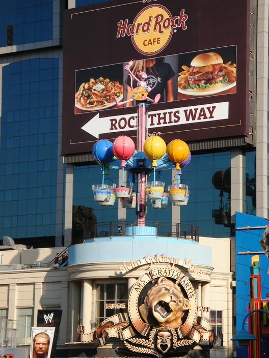
What didn’t make me so happy was walking through all the kitschy, tourist trap, retail/entertainment shops. Seriously, what is the attraction of a wax museum to someone over the age of 10?

But get through it and the view is majestic. To truly appreciate the view, you really have to be on the Canadian side. The last time I was here, I was a kid. We did the walk down the side of the falls on the American side. Somewhere my mom has a picture of my brother and I (with my tongue hanging out) in those fake, going-over-the-falls-in-a-barrel picture.

Enjoy!
Big Wheel - you can see the Falls

Centre Street & Ellen

Amusement ride

Centre Street
Niagara Falls & Horseshoe Falls

Horseshoe Falls - Maid of the Mist Boat down there.

Boat tour, love the winding stairs

Horseshoe Falls & the Canadian side

Niagara Falls
Then suddenly, Jonathan Livingston Seagull made his appearance in the now.